Mount St. Helens Summit via Climber’s Bivouac
- ventureswithvictoria

- Aug 14, 2022
- 3 min read
Updated: 1 day ago
Mount St. Helens Summit via Climber’s Bivouac (aka the summer route)
Distance: 8.2 miles
Elevation Gain: 4583 ft
Location: Gifford Pinchot National Forest, southern Washington
Date Hiked: early November 2019
In early November 2019 I headed up to Washington State for a week of hiking in between residency interviews. I wasn’t expecting to be able to access much in the mountains due to it being shoulder season, so imagine my surprise when I saw on AllTrails that the trail up Mount St. Helens was snow-free and no longer requiring an advance permit. Mount St. Helens is one of the volcanoes that inspired me to study science (specifically volcanology) when I was little. In fact, I specifically wanted to study this volcano and work for the US Geological Survey in Vancouver, Washington. Yeah yeah, I fully embrace my nerdiness. Although I ultimately decided that being a volcanologist was not the career path for me, the love of science and learning stuck. Naturally, I had wanted to climb this volcano for years, and here was my chance.

After making my way to the Mount St. Helens National Volcanic Monument and car camping at the trailhead, I got up early and began making my way up the Ptarmigan Trail. The first two miles through the trees were fairly easy, gaining under 1000 feet in elevation and offering a few glimpses of the surrounding ridges. I did run into a few Canada Jays that were rather bold and made several swoops at my face. Not cool.


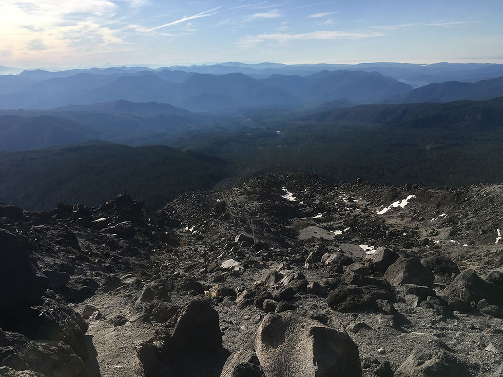
Once I made it through the woods (and past the birds), I looked up at the looming Monitor Ridge, stomach clenching a bit knowing that I was about to have to climb 3700 feet in about 2.7 miles to reach the summit. I quickly came up to the infamous boulder field and began picking my way through and scrambling up the volcanic rocks, often scraping my skin against the sharp edges (pro tip: wear gloves). The route is marked by wooden posts that stick up between the boulders, but they really act as more of a guide to this choose-your-own adventure section.


After scrambling up 2500 feet and reaching the seismic monitoring station, I stopped for a short break to admire the absolutely incredible views of Mt. Hood, Mt. Jefferson, and Mt. Adams, getting lost for a moment in the ridge layers that spread out like ocean waves in front of me.


The next section was a giant ash and scree field that was an absolute bitch (‘scuse the language) to climb. My calves were screaming in agony with every step, and even though I logically knew I was making progress towards the summit, it never seemed like it was getting closer. Helen is such a tease.


When I finally reached the top and the crater came into view, I audibly gasped in excitement (and partially from exhaustion). The view was just spectacular. Looking down at the snow-covered lava dome within the crater and knowing that I was atop one of the most powerful volcanoes in the world, a volcano that inspired me to be who I am today, is a moment that I will not soon forget. Seeing Spirit Lake at the base and Mount Rainier towering in the distance on one side was the whipped cream and cherry on top of an already magnificent view. I took a moment here as well to remember the 57 lives lost in the 1980 eruption.


I spent a while at the summit having lunch and chatting with some other hikers before forcing myself to start the trek back down. Honestly the trek down might be worse than the climb up. I had to take great care coming down the boulder section as one trip or fall onto the sharp rocks could mean serious injury. My knees also didn’t love this section and were very grateful once my feet found the nice soft dirt part of the trail.


This hike took me approximately 8 hours to complete, including breaks. If you want to do this hike, keep in mind that advance permits are required between April 1st and October 31st and are quickly grabbed up so either get them early or consider a summit attempt just before or after the permit period like I did. You can get the permits on the USDA Forest Service website. Outside of these dates you can self-issue your permit at the trailhead. This hike does require a good level of fitness and I would recommend training for it. I was towards the tail end of marathon training and this hike still kicked my butt. But if you can do it, this hike is 100% worth the effort and is a memory you’ll cherish forever.


Comments